Papers by Azriel Yechezkael
Water History, 2025
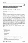
The Mamluks extended their Medieval period control from the water-rich Nile Valley to the dry sou... more The Mamluks extended their Medieval period control from the water-rich Nile Valley to the dry southern Levant. We try to elucidate the Mamluk way of utilizing water energy for sugar production at the Bet She'an Valley. The studied hewn tunnels served some industrial installation. We dated the tunnels to the Mamluks period, suggesting that they fed water to sugar mills, a particularly dominant industry during this period in the region. The tunnels reveal how Mamluks adapted their water technologies to local conditions. Rather than using traditional open aqueducts, which would have been difficult to construct, they carved tunnels through soft tufa rock-showing both engineering ingenuity and pragmatic problem-solving to support a lucrative export industry. This connects local archaeological findings to the broader medieval international trade networks. We show how the brackish water resources were repurposed over centuries-from Mamluk sugar mills to Ottoman flour mills-demonstrating the enduring value of reliable water sources. We demonstrate the importance of looking beyond the obvious remains of aqueducts and dams to find less visible but equally important infrastructure like these tunnels.
קדמוניות, 2024
מתוך המאמר:
במאמר זה אדרש לשני היבטים עיקריים בתופעת מעיינות
הנקבה בארץ־ישראל:
מעיינות הנקבה במר... more מתוך המאמר:
במאמר זה אדרש לשני היבטים עיקריים בתופעת מעיינות
הנקבה בארץ־ישראל:
מעיינות הנקבה במרחב בחינת היקף , מספר ופיזור
מעיינות הנקבה בישראל, ומה ניתן ללמוד מהפיזור המרחבי
הן ברמה הארצית והן ברמה המקומית על התיישבות האדם
בעת העתיקה בארץ־ישראל.
מעיינות הנקבה בציר הזמן - אימתי החלו לחצוב מעיינות
נקבה בישראל, היכן, ובאילו תקופות הם היו נפוצים. לשם
כך יוצגו מספר מקרי בוחן של מעיינות נקבה מתקופות
שונות. יודגש כי בשל חשיבותם כמקור מים לאדם, מעיינות
נקבה שימשו תקופות ארוכות ורצופות, ונרשמו בהם שינויים
טכנולוגיים וסביבתיים. בנוסף יש קושי לתארכם בשל מיעוט
ממצאים ועובדת חציבתם בסלע.
חידושים בארכיאולוגיה של ירושלים וסביבותיה, 2024
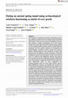
Archaeometry, 2024
Cave pearls are spherical concentric speleothems growing
radially around nuclei in shallow pools ... more Cave pearls are spherical concentric speleothems growing
radially around nuclei in shallow pools saturated
with calcite. They are very rare in the Southern Levant.
We present a unique assemblage of 50 cave pearls
found in the Iron Age Joweizeh artificial spring tunnel
in the Jerusalem Hills of Israel. Some of these deposits
represent the first global evidence of formation on
archaeological artefacts: pottery sherds and ancient
plaster. Multi-analyses were conducted to date and
characterize the different nuclei and pearls. Charcoal
samples extracted from the plaster nuclei of two pearls
were 14C dated to the Hellenistic period. Two pearls
were formed on sherds of Hellenistic lamps. XPS found
Co colour remains, suggesting both had been imported.
The Hellenistic date is also supported by
archaeomagnetic dates of seven other pottery nuclei.
Most Hellenistic remains are probably the outcome of
a renovation campaign in the tunnel. Four pearls were
sampled for stable isotopes (δ13C and δ18O). The range
of δ18O values from the Joweizeh pearls is compatible
with the Holocene Soreq and Jerusalem caves’ records.
The δ13C differences between Joweizeh and Soreq indicate
local changes in the overlying vegetation throughout
history. The various lines of evidence enabled us to
characterize the pearls’ formation process, reconstruct
the Joweizeh spring tunnel’s hydraulic environment
and detect changes that occurred in its water flow
regime throughout history.

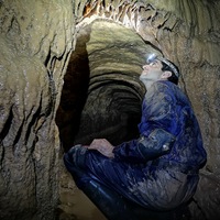
Evolution of water extraction technology (spring tunnels) in the Southern Levant during the last three millennia
Geoarchaeology, Feb 9, 2024
A spring tunnel is an ancient water installation used to artificially increase the water yield of... more A spring tunnel is an ancient water installation used to artificially increase the water yield of a spring through a subterranean tunnel. We have developed a database of 216 spring tunnels documented in the central region of the Southern Levant (present‐day Israel), constructed between Iron Age II and the modern era. The study focuses on the evolution of this water installation over a period of 2500 years, examining these constructions from technological, typological, spatial, and cultural perspectives. Within the larger database, 132 spring tunnels have been mapped, from which we present 36 examples selected to outline the typology and chronology of this type of water installation. The findings of the study indicate a diachronic correlation between the distribution of settlement in the mountain region and the number and geographical distribution of spring tunnels. Ethnic and religious changes, and the complexity of the mountain region's population, are also reflected in the use of these water installations. The comprehensive water structure database presented in this article, from a peripheral, yet strategically located region in relation both to the Far East and to West Mediterranean Empires, is used for initial consideration of local initiatives versus the knowledge‐transfer process

Geoarchaeology , 2024
A spring tunnel is an ancient water installation used to artificially increase the water yield
o... more A spring tunnel is an ancient water installation used to artificially increase the water yield
of a spring through a subterranean tunnel. We have developed a database of 216 spring
tunnels documented in the central region of the Southern Levant (present‐day Israel),
constructed between Iron Age II and the modern era. The study focuses on the evolution
of this water installation over a period of 2500 years, examining these constructions from
technological, typological, spatial, and cultural perspectives. Within the larger database,
132 spring tunnels have been mapped, from which we present 36 examples selected to
outline the typology and chronology of this type of water installation. The findings of the
study indicate a diachronic correlation between the distribution of settlement in the
mountain region and the number and geographical distribution of spring tunnels. Ethnic
and religious changes, and the complexity of the mountain region's population, are also
reflected in the use of these water installations. The comprehensive water structure
database presented in this article, from a peripheral, yet strategically located region in
relation both to the Far East and to West Mediterranean Empires, is used for initial
consideration of local initiatives versus the knowledge‐transfer process
Ancient Spring Tunnels of Jerusalem, Israel: Physical, Spatial, and Human Aspects
Environmental Archaeology, 2021
About 210 spring tunnels were developed in Israel, most of them within its central mountain range... more About 210 spring tunnels were developed in Israel, most of them within its central mountain range and especially in the Jerusalem Hills. This phenomenon probably first appeared in Israel during Iro...

Enviromental Archeology, 2021
About 210 spring tunnels were developed in Israel, most of them within its central mountain range... more About 210 spring tunnels were developed in Israel, most of them within its central mountain range and especially in the Jerusalem Hills. This phenomenon probably first appeared in Israel during Iron Age II, around the 8th century BCE. Spring tunnels are associated with the development of irrigated agricultural systems, landscape design and the establishment of rural settlements. This study presents for the first time a comprehensive statistical picture of this phenomenon, with particularly emphasis on the Jerusalem Hills. We have analysed statistically 21 different parameters of two types of springs in the Jerusalem Hills: 70 with tunnels and 60 without tunnels. The selected parameters fall into three categories: (1) geological-geomorphological (formation, surface slope and group, dip); (2) physicalhydrological (precipitation, discharge, etc.); (3) spatial (dispersion, springs elevation ASL, etc.). The results of this study emphasise the spatial aspects of this phenomenon, especially the accessibility to the Old City of Jerusalem. In addition, there is a clear connection between the karstic aquifer overlying the Moza geological formation and the spring tunnels. This study highlights the physical advantages of Jerusalem's hinterland at the eastern sections of the Soreq and Refaim river basins, consistent with the rich archaeological record in these areas.
Yechezkel, A., Negev, Y., Frumkin, A. and Leibner, U., 2021. The Shaft Tunnel of the Biar aqueduct of Jerusalem: Architecture, hydrology, and dating., 2021
The Biar aqueduct is the most sophisticated of the aqueducts supplying water to Jerusalem during ... more The Biar aqueduct is the most sophisticated of the aqueducts supplying water to Jerusalem during classical periods. It includes the Biar spring, an underground Shaft Tunnel ∼3 km long harvesting groundwater (cuniculus), a dam, a surface channel, and a tunnel traversing a ridge. We conducted a survey of the Biar underground Shaft
The Shaft Tunnel of the Biar aqueduct of Jerusalem: Architecture, hydrology, and dating
Geoarchaeology
The Biar aqueduct is the most sophisticated of the aqueducts supplying water to Jerusalem during ... more The Biar aqueduct is the most sophisticated of the aqueducts supplying water to Jerusalem during classical periods. It includes the Biar spring, an underground Shaft Tunnel ∼3 km long harvesting groundwater (cuniculus), a dam, a surface channel, and a tunnel traversing a ridge. We conducted a survey of the Biar underground Shaft Tunnel, mapping all of its accessible parts (∼1200 m), facilitating a new understanding of the cutting‐edge hydrogeologic and engineering skills used for this project. The last 536 m of the Biar Shaft Tunnel was constructed with a unique ashlar channel, divided into segments, designed to withstand different loads: (a) in a mechanically weak bedrock, a channel with arched gables and barrel vault specus was built within a hewn winding tunnel, (b) when dug as an open shallow trench, a channel roofed with complex gables of ashlars with drafted margins was built, and (c) to release hydraulic pressure, a channel roofed with alternations of barrel vaults and simple gables set perpendicular to the course of the tunnel was constructed. 14Cdatingofplaster samples suggests that the Biar aqueduct was built in the mid‐first century CE and renovated in the days of Aelia Capitolina in the second century CE.

Geoarchaeology, 2021
The Biar aqueduct is the most sophisticated of the aqueducts supplying water to Jerusalem during... more The Biar aqueduct is the most sophisticated of the aqueducts supplying water to Jerusalem during classical periods. It includes the Biar spring, an underground Shaft Tunnel ∼3 km long harvesting groundwater (cuniculus), a dam, a surface channel, and a tunnel traversing a ridge. We conducted a survey of the Biar underground Shaft Tunnel, mapping all of its accessible parts (∼1200 m), facilitating a new understanding of the cutting‐edge hydrogeologic and engineering skills used for this project. The last 536 m of the Biar Shaft Tunnel was constructed with a unique ashlar channel, divided into segments, designed to withstand different loads: (a) in a mechanically weak bedrock, a channel with arched gables and barrel vault specus was built within a hewn winding tunnel, (b) when dug as an open shallow trench, a channel roofed with complex gables of ashlars with drafted margins was built, and (c) to release hydraulic pressure, a channel roofed with alternations of barrel vaults and simple gables set perpendicular to the course of the tunnel was constructed. 14Cdatingofplaster samples suggests that the Biar aqueduct was built in the mid‐first century CE and renovated in the days of Aelia Capitolina in the second century CE.

Environmental Archeology, 2021
About 210 spring tunnels were developed in Israel, most of them within its central mountain range... more About 210 spring tunnels were developed in Israel, most of them within its central mountain range and especially in the Jerusalem Hills. This phenomenon probably first appeared in Israel during Iron Age II, around the 8th century BCE. Spring tunnels are associated with the development of irrigated agricultural systems, landscape design and the establishment of rural settlements. This study presents for the first time a comprehensive statistical picture of this phenomenon, with particularly emphasis on the Jerusalem Hills. We have analysed statistically 21 different parameters of two types of springs in the Jerusalem Hills: 70 with tunnels and 60 without tunnels. The selected parameters fall into three categories: (1) geological-geomorphological (formation, surface slope and group, dip); (2) physicalhydrological (precipitation, discharge, etc.); (3) spatial (dispersion, springs elevation ASL, etc.). The results of this study emphasise the spatial aspects of this phenomenon, especially the accessibility to the Old City of Jerusalem. In addition, there is a clear connection between the karstic aquifer overlying the Moza geological formation and the spring tunnels. This study highlights the physical advantages of Jerusalem's hinterland at the eastern sections of the Soreq and Refaim river basins, consistent with the rich archaeological record in these areas.
Underground Aqueducts Handbook: CRC Press, 2016

חידושים בארכיאולוגיה של ירושלים וסביבותיה, 2021
לירושלים הייתה מאז ומעולם בעיה של אספקת מים בשל מיקומה הטופוגרפי ומיעוט של מקורות
מים יציבים בקרב... more לירושלים הייתה מאז ומעולם בעיה של אספקת מים בשל מיקומה הטופוגרפי ומיעוט של מקורות
מים יציבים בקרבתה. כל עוד אוכלוסיית העיר הייתה מצומצמת, כפי שהיה למשל בתקופת הברזל
2 ) 1000 – 586 לפסה"נ בקירוב(, די היה במי מעיין הגיחון הנובע למרגלותיה ובאיסוף מי נגר עילי
כדי לספק את צורכי תושביה. למן התקופה החשמונאית, במאה הב' לפסה"נ, גדלה ירושלים באופן
מואץ. על פי אומדנים שמרניים, במאה הא' לסה"נ מנתה אוכלוסיית העיר 20,000 – 30,000 נפש )גבע
תשס"ח; רייך תשע"ג(. כמו כן, המים הרבים שנדרשו לעבודת המקדש, והעלייה הניכרת במספר עולי
הרגל שהגיעו לעיר כמה פעמים בשנה )ספראי תש"ף: 214 – 216 (, חייבו מציאת פתרונות לאספקה
סדירה של כמויות גדולות של מים. כמות גדולה של מים נצטרכה גם לאחר חורבן ירושלים, עם ייסודה
של הקולוניה הרומית איליה קפיטולינה בראשית המאה הב' לסה"נ ) Weksler-Bdolah 2019 (. הפתרון
העיקרי למצוקה זו נמצא בהובלת מים העירה באמצעות מערכת של אמות מאזור הר חברון שמדרום
לעיר, שם המעיינות שופעים ונובעים בגובה רב. במערכת זו ארבע אמות מים נפרדות, שבמרכזן שלוש
בריכות אגירה גדולות המכונות "בריכות שלמה".
במאמר זה נידונה האמה שמקורה בנחל הפירים ושהובילה מים מעין הביאר, הנמצא כ־ 16 ק"מ
מדרום לירושלים, אל בריכות שלמה )להלן: 'אמת הביאר'(. אורכה של האמה כ־ 5 ק"מ, ובה חמישה
חלקים עיקריים: מעיין קרסטי, מנהרה תת־קרקעית ובה פירים לאיחוז מי תהום ) Cuniculus ; להלן:
'מנהרת הפירים'(, אמה עילית, מנהרה חוצה רכס )להלן: 'מנהרת דהר בקו'(, ושוב אמה עילית
המסתיימת באזור בריכות שלמה )איור 1(. במאמר נתאר כיצד בעזרת טכנולוגיה מתקדמת ושימוש
בארכיטקטורה ייחודית הצליחו בוני האמה להגדיל באופן ניכר את כמות המים שסופקה לירושלים,
באמצעות פיתוחה של מנהרת הפירים.
נקרות צורים 21, 2021
The Ancient Water System of Ein al-Balad, Abu Ghosh
In this article the ancient water system of E... more The Ancient Water System of Ein al-Balad, Abu Ghosh
In this article the ancient water system of Ein al-Balad in Abu Ghosh is described for the first time; a unique and complex underground system, including a well, a long and impressive water channel and a number of built, hewn stone, shafts.
This underground water system is more than 100 meters long and is among the longest underground systems found so far in the Jerusalem vicinity. The southern section of this system, 53 m long, was discovered by the authors, whilst the northern section, 40 m long was described by De-Vaux in 1950.
In light of the new evidence from this water system, together with historical and archaeological evidences, it has been proven that this is the water source that currently discharges near the Nabi Uzer Mosque. This mosque is located near a caravanserai (Khan) from the Early Islamic period, which was also in use during the Mamluk period. The section of the water system that is documented here for the first time, may refer to these periods.
The water system of Ein al-Balad is similar in some characteristics to a water system known as Kanat: i.e channeling of water from a deep well, using a long channel integrated with shafts, to the surface. In this sense, Ein al-Balad water system differs from the many spring tunnels found in the Jerusalem hills.
In addition, it demonstrates the creativity of mountain settlers in the past as they come to find technological and engineering solutions for water scarcity.

נקרות צורים 21, 2021
Cave Pearls are a unique type of a spherical concentric speleothem. These speleothems grow radial... more Cave Pearls are a unique type of a spherical concentric speleothem. These speleothems grow radially around a nuclei in shallow pools saturated with calcite or aragonite. Cave pearls are common in many countries around the world, yet are rare in Israel caves. In this article, a unique assemblage of 50 cave pearls found in the Joweizeh spring tunnel is described. The cave pearls were formed on a variety of cores - fragments of potsherds, stones, pieces of marl and ancient plaster. An attempt was made to date the time of the formation of these cave pearls - and in accordance the usage of the tunnel, using radiometric dating of Uranium-Thorium and stable isotopes of O18 and C13. These methods were only partially successful, probably due to the high porosity of the pearls.
Typologically, most of the cave pearls are 'Pisoliths' -due to their shape, diameter, porosity, and especially because the environment in which we assume there were formed: near rimstone dams that are found in the Joweizeh tunnel. The rough surface, which characterizes all pearls, were formed under slow flow of water. Rapid crystallization of the pearls indicates that water is saturated with high percentage of calcite.
אופקים בגיאוגרפיה, 2019
Over 190 Spring Tunnels were built in the Land of Israel in the course of history. The majority o... more Over 190 Spring Tunnels were built in the Land of Israel in the course of history. The majority of these tunnels are located within Israel's central mountain range and especially in the Jerusalem hills. The phenomenon probably dates back to the Iron Age II )2700 years BP( and is closely associated with the development of irrigated farming systems, landscape design and the establishment of agricultural settlements. This study presents a comprehensive picture of this phenomenon, by using advanced research tools such as GIS, and is based on the statistical comparison of 21 different parameters for two kinds of springs in the Jerusalem hills: 69 with tunnels and 61 without tunnels. The selected parameters are divided into three categories: Geological-geomorphological characteristics )formation, soil group, dip(, physical-hydrological )slope, precipitation, discharge etc.( and spatial characteristics )elevation differences with nearest ridge/stream channel, distance from Jerusalem, etc.(.
אופקים בגיאוגרפיה, 2019
In this study, the influence of annual and multiannual precipitation on the discharge of a large ... more In this study, the influence of annual and multiannual precipitation on the discharge of a large number of perched springs )n=36(, in the Jerusalem hills was examined. The analysis is based on records of the changes in water volume of springs' storage reservoirs over the years 2002/03-2012/13, and is classified by geological formation of springs and elevation difference between the spring reservoir and the nearest ridge.
Studies on the Land of Judea: Proceedings of the 3rd Annual Conference in Memory of Dr. David Amit, 2019
Uploads
Papers by Azriel Yechezkael
במאמר זה אדרש לשני היבטים עיקריים בתופעת מעיינות
הנקבה בארץ־ישראל:
מעיינות הנקבה במרחב בחינת היקף , מספר ופיזור
מעיינות הנקבה בישראל, ומה ניתן ללמוד מהפיזור המרחבי
הן ברמה הארצית והן ברמה המקומית על התיישבות האדם
בעת העתיקה בארץ־ישראל.
מעיינות הנקבה בציר הזמן - אימתי החלו לחצוב מעיינות
נקבה בישראל, היכן, ובאילו תקופות הם היו נפוצים. לשם
כך יוצגו מספר מקרי בוחן של מעיינות נקבה מתקופות
שונות. יודגש כי בשל חשיבותם כמקור מים לאדם, מעיינות
נקבה שימשו תקופות ארוכות ורצופות, ונרשמו בהם שינויים
טכנולוגיים וסביבתיים. בנוסף יש קושי לתארכם בשל מיעוט
ממצאים ועובדת חציבתם בסלע.
radially around nuclei in shallow pools saturated
with calcite. They are very rare in the Southern Levant.
We present a unique assemblage of 50 cave pearls
found in the Iron Age Joweizeh artificial spring tunnel
in the Jerusalem Hills of Israel. Some of these deposits
represent the first global evidence of formation on
archaeological artefacts: pottery sherds and ancient
plaster. Multi-analyses were conducted to date and
characterize the different nuclei and pearls. Charcoal
samples extracted from the plaster nuclei of two pearls
were 14C dated to the Hellenistic period. Two pearls
were formed on sherds of Hellenistic lamps. XPS found
Co colour remains, suggesting both had been imported.
The Hellenistic date is also supported by
archaeomagnetic dates of seven other pottery nuclei.
Most Hellenistic remains are probably the outcome of
a renovation campaign in the tunnel. Four pearls were
sampled for stable isotopes (δ13C and δ18O). The range
of δ18O values from the Joweizeh pearls is compatible
with the Holocene Soreq and Jerusalem caves’ records.
The δ13C differences between Joweizeh and Soreq indicate
local changes in the overlying vegetation throughout
history. The various lines of evidence enabled us to
characterize the pearls’ formation process, reconstruct
the Joweizeh spring tunnel’s hydraulic environment
and detect changes that occurred in its water flow
regime throughout history.
of a spring through a subterranean tunnel. We have developed a database of 216 spring
tunnels documented in the central region of the Southern Levant (present‐day Israel),
constructed between Iron Age II and the modern era. The study focuses on the evolution
of this water installation over a period of 2500 years, examining these constructions from
technological, typological, spatial, and cultural perspectives. Within the larger database,
132 spring tunnels have been mapped, from which we present 36 examples selected to
outline the typology and chronology of this type of water installation. The findings of the
study indicate a diachronic correlation between the distribution of settlement in the
mountain region and the number and geographical distribution of spring tunnels. Ethnic
and religious changes, and the complexity of the mountain region's population, are also
reflected in the use of these water installations. The comprehensive water structure
database presented in this article, from a peripheral, yet strategically located region in
relation both to the Far East and to West Mediterranean Empires, is used for initial
consideration of local initiatives versus the knowledge‐transfer process
מים יציבים בקרבתה. כל עוד אוכלוסיית העיר הייתה מצומצמת, כפי שהיה למשל בתקופת הברזל
2 ) 1000 – 586 לפסה"נ בקירוב(, די היה במי מעיין הגיחון הנובע למרגלותיה ובאיסוף מי נגר עילי
כדי לספק את צורכי תושביה. למן התקופה החשמונאית, במאה הב' לפסה"נ, גדלה ירושלים באופן
מואץ. על פי אומדנים שמרניים, במאה הא' לסה"נ מנתה אוכלוסיית העיר 20,000 – 30,000 נפש )גבע
תשס"ח; רייך תשע"ג(. כמו כן, המים הרבים שנדרשו לעבודת המקדש, והעלייה הניכרת במספר עולי
הרגל שהגיעו לעיר כמה פעמים בשנה )ספראי תש"ף: 214 – 216 (, חייבו מציאת פתרונות לאספקה
סדירה של כמויות גדולות של מים. כמות גדולה של מים נצטרכה גם לאחר חורבן ירושלים, עם ייסודה
של הקולוניה הרומית איליה קפיטולינה בראשית המאה הב' לסה"נ ) Weksler-Bdolah 2019 (. הפתרון
העיקרי למצוקה זו נמצא בהובלת מים העירה באמצעות מערכת של אמות מאזור הר חברון שמדרום
לעיר, שם המעיינות שופעים ונובעים בגובה רב. במערכת זו ארבע אמות מים נפרדות, שבמרכזן שלוש
בריכות אגירה גדולות המכונות "בריכות שלמה".
במאמר זה נידונה האמה שמקורה בנחל הפירים ושהובילה מים מעין הביאר, הנמצא כ־ 16 ק"מ
מדרום לירושלים, אל בריכות שלמה )להלן: 'אמת הביאר'(. אורכה של האמה כ־ 5 ק"מ, ובה חמישה
חלקים עיקריים: מעיין קרסטי, מנהרה תת־קרקעית ובה פירים לאיחוז מי תהום ) Cuniculus ; להלן:
'מנהרת הפירים'(, אמה עילית, מנהרה חוצה רכס )להלן: 'מנהרת דהר בקו'(, ושוב אמה עילית
המסתיימת באזור בריכות שלמה )איור 1(. במאמר נתאר כיצד בעזרת טכנולוגיה מתקדמת ושימוש
בארכיטקטורה ייחודית הצליחו בוני האמה להגדיל באופן ניכר את כמות המים שסופקה לירושלים,
באמצעות פיתוחה של מנהרת הפירים.
In this article the ancient water system of Ein al-Balad in Abu Ghosh is described for the first time; a unique and complex underground system, including a well, a long and impressive water channel and a number of built, hewn stone, shafts.
This underground water system is more than 100 meters long and is among the longest underground systems found so far in the Jerusalem vicinity. The southern section of this system, 53 m long, was discovered by the authors, whilst the northern section, 40 m long was described by De-Vaux in 1950.
In light of the new evidence from this water system, together with historical and archaeological evidences, it has been proven that this is the water source that currently discharges near the Nabi Uzer Mosque. This mosque is located near a caravanserai (Khan) from the Early Islamic period, which was also in use during the Mamluk period. The section of the water system that is documented here for the first time, may refer to these periods.
The water system of Ein al-Balad is similar in some characteristics to a water system known as Kanat: i.e channeling of water from a deep well, using a long channel integrated with shafts, to the surface. In this sense, Ein al-Balad water system differs from the many spring tunnels found in the Jerusalem hills.
In addition, it demonstrates the creativity of mountain settlers in the past as they come to find technological and engineering solutions for water scarcity.
Typologically, most of the cave pearls are 'Pisoliths' -due to their shape, diameter, porosity, and especially because the environment in which we assume there were formed: near rimstone dams that are found in the Joweizeh tunnel. The rough surface, which characterizes all pearls, were formed under slow flow of water. Rapid crystallization of the pearls indicates that water is saturated with high percentage of calcite.