Books by Etienne Lallau
Mémoire de la fédération des Sociétés d'Histoire et d'Archéologie de l'Aisne, tome LXVI, 2021
Article sur la Fronde dans l'Aisne, sur les préparatifs du siège de Coucy et son déroulé en 1652
Papers by Etienne Lallau
Bulletin de la Société des Etudes du Lot, tome 146, (3e fascicule), juillet-septembre 2025,, 2025
n départementale : une longue histoire carcérale (première partie), in : Bulletin de la Société des Etudes du Lot, tome 146, (2e fascicule), avril-juin 2025, 2025

La lutte contre l’obsolescence des villes fortifiées picardes au XVIe siècle : l’adoption du système remparé
Lalau, Étienne. « La lutte contre l’obsolescence des villes fortifiées picardes au XVIe siècle : l’adoption du système remparé ». Places fortes des Hauts-de-France – 5 –, édité par Thomas Byhet et Christine Aubry, Publications de l’Institut de recherches historiques du Septentrion, 2025, https://..., 2025
Bulletin de la Société des études du Lot, tome 145, pp. 166, 193, 2024
Bulletin de la Société des Etudes du Lot, tome 145, pp. 81-114, 2024
Bulletin monumental, 179-1, pp. 11-30, 2021
Le couvent des Clarisses à Nogent-l'Artaud (Aisne), dans : Mémoires de la Fédération des Sociétés d'Histoire et d'Archéologie de l'Aisne, tome LXV, p.133-171, 2020
Revue archéologique de Picardie, 2016
The present article recounts the last discoveries from the tour Lhermitte, a component of the urban surrounding walls of the fortified complex in Coucy-le-Château. In this tower, two recent archaeological studies led to unhoped-for findings. Indeed, interesting pieces of furniture were found, and excavations allowed archaeologists to better understand the original appearance of the structure, thanks to the unexpected discovery of a lower room. Furthermore, these operations revealed several phases corresponding to the adaptation of the tower to the development of powder artillery. These phases, in a good fossilized state, are directly related to the history of Coucy. Thus, these discoveries, although they raise new questions, provide a novel overview of the defensive development of the place, from the end of the XIVth century to the final dismantling of the fortifications, after the Fronde, in 1652.
Dieser Artikel hat zum Ziel, die jüngsten Entdeckungen zu schildern, die auf dem Turm Lhermitte gemacht wurden. Der Turm Lhermitte ist Bestandteil der städtischen Ringmauer der Festungsanlage Coucy-le-Château. Zwei neu durchgeführte archäologische Studien haben nämlich zu unverhofften Ergebnissen geführt. Neben der Aufdeckung eines interessanten Mobiliar-Satzes haben die Ausgrabungen erlaubt, die ursprüngliche Gestalt der Baustruktur mit der überraschenden Entdeckung eines Kellerraums besser zu erfassen. Auβerdem haben diese Vorgänge verschiedene Entwicklungsphasen aufgedeckt, um den Turm der Entwicklung der Pulverartillerie anzupassen. Diese Phasen sind sehr gut versteinert und stehen in direktem Zusammenhang mit der Geschichte von Coucy. Wenngleich sich dadurch neue Fragen ergeben, bieten diese Entdeckungen einen einzigartigen Überblick der defensiven Entwicklung der Festungsanlage vom Ende des 14. Jahrhunderts bis zum endgültigen Abbau der Befestigungen nach dem Bürgerkrieg der Fronde im Jahre 1652.
Bulletin monumental,n°176/4,p. 325-328, 2018
Revue archéologique de Picardie, 2016
The present article recounts the last discoveries from the tour Lhermitte, a component of the urban surrounding walls of the fortified complex in Coucy-le-Château. In this tower, two recent archaeological studies led to unhoped-for findings. Indeed, interesting pieces of furniture were found, and excavations allowed archaeologists to better understand the original appearance of the structure, thanks to the unexpected discovery of a lower room. Furthermore, these operations revealed several phases corresponding to the adaptation of the tower to the development of powder artillery. These phases, in a good fossilized state, are directly related to the history of Coucy. Thus, these discoveries, although they raise new questions, provide a novel overview of the defensive development of the place, from the end of the XIVth century to the final dismantling of the fortifications, after the Fronde, in 1652.
Dieser Artikel hat zum Ziel, die jüngsten Entdeckungen zu schildern, die auf dem Turm Lhermitte gemacht wurden. Der Turm Lhermitte ist Bestandteil der städtischen Ringmauer der Festungsanlage Coucy-le-Château. Zwei neu durchgeführte archäologische Studien haben nämlich zu unverhofften Ergebnissen geführt. Neben der Aufdeckung eines interessanten Mobiliar-Satzes haben die Ausgrabungen erlaubt, die ursprüngliche Gestalt der Baustruktur mit der überraschenden Entdeckung eines Kellerraums besser zu erfassen. Auβerdem haben diese Vorgänge verschiedene Entwicklungsphasen aufgedeckt, um den Turm der Entwicklung der Pulverartillerie anzupassen. Diese Phasen sind sehr gut versteinert und stehen in direktem Zusammenhang mit der Geschichte von Coucy. Wenngleich sich dadurch neue Fragen ergeben, bieten diese Entdeckungen einen einzigartigen Überblick der defensiven Entwicklung der Festungsanlage vom Ende des 14. Jahrhunderts bis zum endgültigen Abbau der Befestigungen nach dem Bürgerkrieg der Fronde im Jahre 1652.
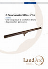
Abstract: In archeological situations, to find artillery pieces is extremely rare. Thus, the recent finding in the archives of the Bibliothèque nationale de France of precise drawings of a " cannon " discovered in 1857 at the foot of the main tower of Coucy, is particularly interesting. The present investigation, identifying this piece as an hackbut with a hook, is a good opportunity to review this sort of weapon, which remains poorly known, and to offer a few comparisons in particular with regards to the parisian production from the first half of the 16 th century.
Rapports d'opération by Etienne Lallau
Ce réseau délimite notamment l’ancienne prêtrière de la Malmaison, qui, sous l’Ancien Régime, participe des terres du chapitre de Chartres. L’extension de ce domaine correspond peu ou prou aux limites communales actuelles d’Émancé, auxquelles il faut ajouter les anciennes terres du Fléau qui se trouvent aujourd’hui sur la commune de Saint-Hilarion. Ces bornes matérialisent également certaines frontières de l’ancienne seigneurie des Prunelé, tant au nord qu’au sud du domaine, en limite avec la Malmaison. Ce bornage a vraisemblablement été disposé entre le début du XVIe siècle et la seconde moitié du XVIIe siècle. Certaines bornes peuvent être attribuées avec certitude au XVIe siècle. Il est tentant d’étendre cette datation à l’ensemble du corpus étant données certaines similitudes morphologiques.
Des données d’ordre technique ont aussi été appréhendées. D’une part, la manière de lire ces bornes a été déterminée. D’autre part, les méthodes d’implantation, en particulier la question du cadencement, a été approchée grâce aux minutes d’un procès du XVIe siècle opposant les Prunelé, seigneurs de Gazeran aux Silly, seigneurs de Rochefort. En confrontant ces textes aux informations de terrain, on constate l’ascendance du paysage et de ses contraintes sur la décision de justice.
La matérialisation des frontières par ce réseau semble discontinue. Les bornes s’avèrent en effet localisées le plus souvent au niveau des zones de “conflits de voisinage”. Ces rivalités puisent notamment leurs racines dans des préoccupations d’ordre économique, liées, selon toute évidence dans le secteur, à la gestion de l’espace forestier.
Enfin, on constate une superposition quasi-systématique entre les frontières des anciennes seigneuries foncières et celles des limites des ressorts paroissiaux fixés à la Révolution par la trame des communes.