Conferences, Talks by Gervasio Illiano
In cities worldwide, urban expansion and renewal are increasingly accompanied by archaeological r... more In cities worldwide, urban expansion and renewal are increasingly accompanied by archaeological research. The massive presence of archaeological layers in many historical city centres, previously rather considered as an obstacle to urban growth, is now commonly perceived as an added value and a potential asset for development. This workshop, organized by CLUE+ and the Naples University "Federico II" (Dipartimento di Studi Umanistici) in cooperation with Herity International, analyses the pitfalls and opportunities of this phenomenon, as well as the methods and procedures employed in the various steps involved, from data acquisition, documentation and storage to the integration of these data in heritage policies, urban planning and design. The two days-conference is divided into three sessions, each focusing on a specific theme: (1) Documenting archaeology. In this session we will analyse the problem of data recovery and documentation in urbanized areas, discussing advanced approaches to archaeological excavation, survey, remote sensing and other methods in highly stratified and low visibility contexts. (2) Data storage. In this session we will focus on the complex task of storing archaeological data in modern cities. The different methods of archaeological investigation , from remote sensing to cartography, produce a multi-faceted set of data, requiring dynamic archives and databases. The session will focus on innovative methods that allow the integration of different types of information and that facilitate the stage of data interpretation. (3) Archaeology, heritage and urban planning. This session is dedicated to the integration of archaeology into urban planning and design strategies. Throughout Europe, planners and policy makers are increasingly approaching archaeology, and more generally cultural heritage, as social, cultural or economic capital, with which to build sustainable future cities. In this session a series of case studies will be presented, to be accompanied by a discussion of the pros and contras of this development.
Paesaggi funerari a Baiae e Misenum tra dati archeologici e cost path analysis
Dialoghi sull’Archeologia della Magna Grecia e del Mediterraneo. Paestum, 16-18 novembre 2018
L’acqua e la città in età romana. Convegno di studi. Feltre, 3-4 novembre 2017
Misenum. Nuovi dati e prospettive di ricerca. Ciclo di conferenze "I sabati di Baia" organizzate dal Museo Archeologico dei Campi Flegrei
"Misenum. The harbour and the city. Landscapes in context". KAINUA 2017. International Conference on Knowledge, Analysis and Innovative Methods for the study and the dissemination of ancient urban areas. Bologna 18-21 aprile 2017.
zione in Beni architettonici e del Paesaggio e realizzata con il contributo dell'Università degli... more zione in Beni architettonici e del Paesaggio e realizzata con il contributo dell'Università degli Studi di Napoli Federico II.
Water Management e territorio. Nuovi dati sul percorso dell’acquedotto del Serino tra Baiae e Misenum, in Expert Meeting: Water Management in Italy from Antiquity through the Early Modern Period, KNIR 4-5 giugno 2015
Primi dati per lo studio topografico delle ville marittime tra Baiae e Misenum, in "Abitare nel golfo di Napoli". Giornata di studi in collaborazione con la Soprintendenza per i Beni Archeologici di Napoli. Baia, 31/10/14
Papers by Gervasio Illiano
Le memorie del Comandante, 2022
La ricerca archeologica sulle ville costiere nei Campi Flegrei ha dedicato qualche momento di rif... more La ricerca archeologica sulle ville costiere nei Campi Flegrei ha dedicato qualche momento di riflessione sulle possibilità di individuare nei numerosi avanzi di antichità i resti di quella che fu la residenza del prefetto della flotta militare di Miseno. Tale dibattito veniva stimolato essenzialmente dal fascino che suscitava-e tuttora suscitanell'immaginario collettivo il nome del più illustre dei comandanti militari, Plinio il Vecchio, le cui ultime tragiche ore di vita lo videro partire proprio da Miseno alla volta della costa vesuviana. La scarsità di dati a disposizione ha dato origine ad una serie di ipotesi tra loro contrastanti, ma nessuna supportata da elementi rassicuranti. Il contributo che segue, estratto parzialmente dalla mia tesi di dottorato, prova a fare ordine nel complesso dibattito sulla localizzazione della sede del praefectus classis Misenensis proponendo per la prima volta una correlazione tra palinsesto archeologico e analisi spaziale in ambiente GIS: l'analisi della visibilità effettuata permetterà di individuare quali punti del territorio in esame rispondessero maggiormente alle necessità strategiche della sede del comandante della flotta, in relazione al vicino porto, alla città e all'intero golfo di Napoli, suggerendo non solamente un'ipotesi per la corretta localizzazione della villa di Plinio, ma anche rilevando i criteri urbanistici-finora poco analizzati-che distinsero l'ambizioso progetto urbanistico di Augusto a Miseno.
La difesa militare bizantina in Italia (secoli VI-XI), Atti del convegno internazionale (Squillace, 15-18 aprile 2021), 2022
L’utilizzo della viewshed analysis per la risoluzione di un quesito di topografia flegrea
Archeologia e Calcolatori, 2018
Archaeology in the City. Proceedings of the International Workshop, Amsterdam 16-17 October 2019, 2021
The area called Phlegraean Fields, in the Gulf of Naples (Italy), is an interesting context for t... more The area called Phlegraean Fields, in the Gulf of Naples (Italy), is an interesting context for the archaeological research due to the massive amount of evidences still preserved within the modern urban fabric. The PhD project conducted by the author focused on the reconstruction of ancient settlement patterns of Misenum (in the modern City of Bacoli) and its territory, facing the methodological challenges of landscape archaeology in multi-layered urban areas. Data collection produced the first GIS-based archaeological map of Misenum that is useful both for heritage preservation and for
studying the settlement dynamics. The case of Bacoli is a good example to show the limits but also the potentialities of archaeological cartography to detect the markers of ancient territorial patterns. I will be presenting some examples where the use of archaeological cartography proved to be profitable toward the analysis of the ancient landscape dynamics. As the case of Bacoli has proved, the correct use of archaeological cartography can detect the signs of past topography within the modern urban pattern, investigating the configuration of the ancient landscape.

Archeologia e Calcolatori, 2018
The location of the ancient district of Bauli has always had a central role within the archaeolog... more The location of the ancient district of Bauli has always had a central role within the archaeological research in the so-called Campi Flegrei, in the Gulf of Naples. Ancient literary sources mentioned this place in relation to the well-known phenomenon of "villa society" that characterized the Gulf of Naples, especially the Baiae-Misenum peninsula. Cicero, Pliny the Elder and Varro mentioned Bauli as the place of the orator Q. Hortensius Hortalus' maritime villa, which was particularly famous for its many fishponds. Other literary sources have contributed to reinforce the thesis, strongly defended by Amedeo Maiuri, that ancient Bauli was located at the place of modern Bacoli, where many remains of fishponds and other ancient buildings are considered to have been part of Hortensius' villa in Bauli. Few eminent scholars - such as Karl J. Beloch - contrasted this theory, proposing a different interpretation of the ancient texts that has led to locate Bauli near the Lu...
Archeologia e Calcolatori, 2017
The interest of archaeological research on the Phlegraean Fields, in the Gulf of Naples, has been... more The interest of archaeological research on the Phlegraean Fields, in the Gulf of Naples, has been often concentrated on different topics: monumental architecture, thermalism, coastal otium villas. However, we are still missing a reasonable reconstruction of the ancient landscapes of the area with special regard to the peninsula between Baiae and Misenum. The recent PhD project at the Vrije Universiteit Amsterdam has had the task of filling in the gap in local modern archaeology, and shifting the level of analysis from the ‘site’ to the ‘territory’: the study of individual monuments and surviving archaeological assemblages of the Roman town of Misenum, the main harbour for the Imperial navy, is now a part of the investigation of the urban organization of the municipium. The use of a dynamic and multidisciplinary research strategy has led to the creation of a new archaeological map for the area being investigated.
Una villa romana a Capo Miseno. Dati preliminari e riflessioni su proprietari e ville nel Golfo di Napoli
Oebalus. Studi sulla Campania nell’antichità, 2018
Archeologia e Calcolatori, 2018
The location of the ancient district of Bauli has always had a central role within the archaeolog... more The location of the ancient district of Bauli has always had a central role within the archaeological research in the so-called Campi Flegrei, in the Gulf of Naples. Ancient literary sources mentioned this place in relation to the well-known phenomenon of “villa society” that characterized the Gulf of Naples, especially the Baiae-Misenum peninsula. Cicero, Pliny the Elder and Varro mentioned Bauli as the place of the orator Q. Hortensius Hortalus’ maritime villa, which was particularly famous for its many fishponds. Other literary sources have contributed to reinforce the thesis, strongly defended by Amedeo Maiuri, that ancient Bauli was located at the place of modern Bacoli, where many remains of fishponds and other ancient buildings are considered to have been part of Hortensius’ villa in Bauli. Few eminent scholars – such as Karl J. Beloch – contrasted this theory, proposing a different interpretation of the ancient texts that has led to locate Bauli near the Lucrino Lake, E of Baiae. The goal of this paper is to present new data from GIS spatial analysis that can contribute to evaluate both theories and to answer the question about the location of Bauli. The viewshed analysis tested Cicero’s passage stating that from Hortensius’ villa in Bauli it would have been possible to see his villa in Pompeii if the distance was shorter. The viewshed rasters calculated for three observation points corresponding to Maiuri’s and Beloch’s location of Bauli provide new important data for the solution of this topographical question. By relating spatial analysis to the information reported by the ancient sources, together with the archaeological traces, it is possible to confirm the hypothesis that Bauli was located between Baiae and Misenum, in the modern town of Bacoli.
by Eugenio Tamburrino, Massimo Brando, Valentina Pica, Francesco Marco Paolo Carrera, dario rose, Gervasio Illiano, Davide Gangale Risoleo, Ugo Fusco, Daniele De Simone, Alka Starac, Paolo Bonini, Gatti Sandra, Mark Locicero, Sven Kühn, Dylan K Rogers, Diego Peirano, Saskia Kerschbaum, Santiago Sánchez de la Parra Pérez, Raffaella Iovine, Giovanni Polizzi, Eleonora Romanò, Fabiana Susini, Marina Marcelli, and Francesco Maria Cifarelli Libro degli abstract del convegno di studi "L'acqua e la città in età romana - Water and the Roma... more Libro degli abstract del convegno di studi "L'acqua e la città in età romana - Water and the Roman cities and settlements" - Feltre (BL - Italia), 3/4 Novembre 2017.
KNOWLEDGE, ANALYSIS AND INNOVATIVE METHODS FOR THE STUDY AND THE DISSEMINATION OF ANCIENT URBAN AREAS Proceedings of the KAINUA 2017 International Conference in Honour of Professor Giuseppe Sassatelli’s 70th Birthday (Bologna, 18-21 April 2017), 2017
The interest of archaeological research on the Phlegraean Fields, in the Gulf of Naples, has been... more The interest of archaeological research on the Phlegraean Fields, in the Gulf of Naples, has been often concentrated on different topics: monumental architecture, thermalism, coastal otium villas. However, we are still missing a reasonable reconstruction of the ancient land- scapes of the area with special regard to the peninsula between Baiae and Misenum. The recent PhD project at the Vrije Universiteit Amsterdam has had the task of lling in the gap in local modern archaeology, and shifting the level of analysis from the “site” to the “territory”: the study of individual monuments and surviving archaeological assemblages of the Roman town of Misenum, the main harbour for the Imperial navy, is now a part of the investigation of the urban organization of the municipium. The use of a dynamic and multidisciplinary research strategy has led to the creation of a new archaeological map for the area being investigated.
388
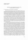
Misenum: the harbour and the city. Landscapes in context
Furthermore, geophysical surveys over the area near the military port and the town centre has implemented the data available, contributing, for the very rst time, toward a better and more detailed understanding of the organization of the harbour district, in relation with the political and civic core of Roman Misenum. Thanks to GIS applications it is now possible to launch an analytical examination of the urban fabric within the Misenum peninsula. On one hand, it has been possible to increase the amount of information at our disposal and, on the other hand, to propose a panorama of landscape dynamics for the Misenum territory whose massive amount of archaeological evidence appear to be extremely fragmented by human (modern urbanization) and natural factors (bradyseism).
Uploads
Conferences, Talks by Gervasio Illiano
Papers by Gervasio Illiano
studying the settlement dynamics. The case of Bacoli is a good example to show the limits but also the potentialities of archaeological cartography to detect the markers of ancient territorial patterns. I will be presenting some examples where the use of archaeological cartography proved to be profitable toward the analysis of the ancient landscape dynamics. As the case of Bacoli has proved, the correct use of archaeological cartography can detect the signs of past topography within the modern urban pattern, investigating the configuration of the ancient landscape.
388
Misenum: the harbour and the city. Landscapes in context
Furthermore, geophysical surveys over the area near the military port and the town centre has implemented the data available, contributing, for the very rst time, toward a better and more detailed understanding of the organization of the harbour district, in relation with the political and civic core of Roman Misenum. Thanks to GIS applications it is now possible to launch an analytical examination of the urban fabric within the Misenum peninsula. On one hand, it has been possible to increase the amount of information at our disposal and, on the other hand, to propose a panorama of landscape dynamics for the Misenum territory whose massive amount of archaeological evidence appear to be extremely fragmented by human (modern urbanization) and natural factors (bradyseism).