Guilin Karst Landscape
Overview
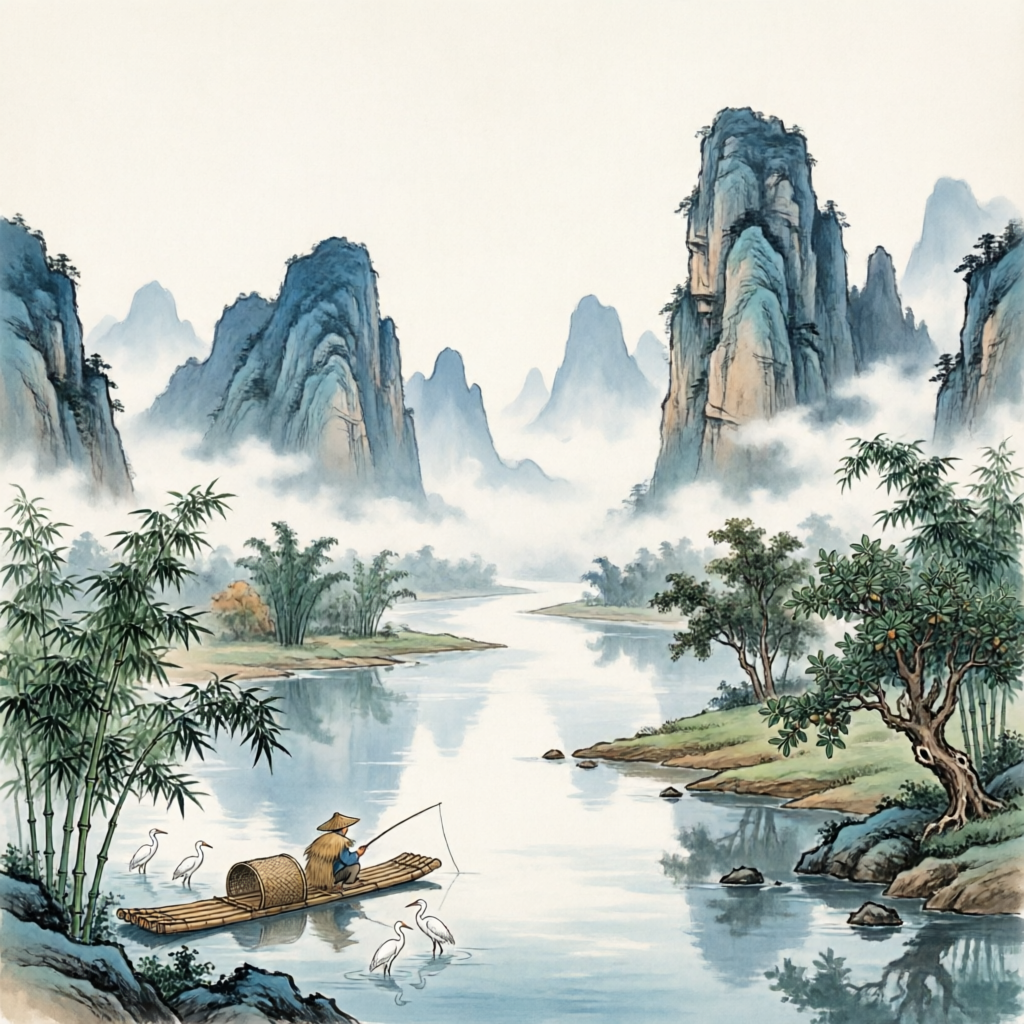
Guilin Karst Landscape refers to the distinctive topography and scenic areas surrounding Guilin City in northeastern Guangxi Zhuang Autonomous Region. This natural wonder is renowned for its spectacular limestone karst formations, including peaks, caves, and winding rivers that have inspired countless works of Chinese art and poetry for centuries. The region encompasses a diverse range of geological features, with the Li River serving as the central artery connecting many of the area's most famous attractions. In 2014, the South China Karst, with Guilin as its centerpiece, was inscribed as a UNESCO World Heritage Site, recognizing its outstanding universal value and geological significance.
History
The karst topography of Guilin, characterized by the coexistence of peak forests (on plains) and peak clusters (in depressions), represents the inevitable result of this地貌系统 (landform system) evolving toward greater order. [39] The region's geological development has been influenced by groundwater and direct precipitation, resulting in comprehensive karst processes. Beyond typical chemical dissolution, water erosion, and collapse processes, biological karstification—particularly plant-related phenomena—is prevalent in the area.
The evolution of karst peak landforms follows a sequential progression: from peak cluster depressions to peak forests, and finally to isolated peak plains. These three stages represent the youth, maturity, and old age phases of karst development respectively. [39] The bedrock of Guilin consists primarily of carbonate rocks, mainly calcium carbonate (CaCO₃). When exposed to water and carbon dioxide, these rocks undergo chemical reactions to form soluble calcium bicarbonate [Ca(HCO₃)₂]. As this reaction continues over time, extensive cave systems develop in well-drained underground rock layers. When water containing dissolved bicarbonates flows through these caves, it may redeposit insoluble carbonates, forming stalactites (hanging from cave ceilings) and stalagmites (rising from cave floors). [36]
Key Information
| Feature | Description |
|---|---|
| Location | Northeastern Guangxi Zhuang Autonomous Region, southern end of the Xianggui Corridor [6] |
| Average Altitude | Approximately 150 meters [4] |
| Climate | Subtropical monsoon climate with mild temperatures, abundant rainfall, and distinct seasons [13] |
| Geology | Primarily karst topography formed from carbonate rocks [14] |
| Main Attractions | Three Mountains (Elephant Trunk Hill, Pagoda Hill, Nine-Horse Painting Hill), Two Caves (Seven Star Crags, Reed Flute Cave), One River (Li River) [37] |
| UNESCO Status | Part of the South China Karst World Heritage Site inscribed in 2014 [33] |
Cultural Significance
The natural beauty of Guilin has profoundly influenced Chinese culture and art for centuries. The landscape has been immortalized in countless paintings, poems, and literary works, becoming a symbol of the idealized Chinese natural landscape. In modern times, "Guilin Landscape" was featured as the background image on the 20 yuan banknote of China's fifth series of renminbi, further cementing its place in national consciousness. [2]
The region is also home to rich cultural traditions. Guilin Opera (桂剧, Guiju), one of Guangxi's most representative theatrical forms, dates back to the Ming and Qing dynasties. With a repertoire of approximately 800 plays, including "Hitting the Golden Branch," "Descending the Mountain by the Fire," and "Meeting on the Broken Bridge," it represents an important part of local cultural heritage. [29]
Culinary traditions also reflect the region's cultural identity. Guilin Rice Noodles, a snack with a history dating back to the Qin Dynasty, is renowned for its unique flavor and has been celebrated in the annual Guilin Rice Noodle Festival since 2007. [30] Another notable local specialty is Guilin Nun's Noodles (桂林尼姑面), originally a vegetarian dish prepared by nuns at the Yuezhen Temple on Crescent Moon Mountain for pilgrims. [30]
Modern Status
Today, Guilin Karst Landscape remains one of China's premier tourist destinations, attracting millions of visitors annually. The region's tourism infrastructure has developed significantly while attempting to balance preservation and development. Major attractions include:
- Elephant Trunk Hill: The iconic symbol of Guilin, named for its resemblance to an elephant drinking from the Li River. [38]
- Li River: The centerpiece of the region's landscape, a 43.5-kilometer-long tributary in Yangshuo often called "Little Li River." [24]
- Reed Flute Cave: Known as the "Art Palace of Nature" for its stunning stalactite and stalagmite formations. [40]
- Longji Rice Terraces: Agricultural terraces constructed over centuries on the mountain slopes, with a reputation as "the world's finest rice terraces." [16]
- Seven Star Crags: A scenic area covering 137.4 hectares, named for its seven peaks resembling the Big Dipper constellation. [41]
Recent developments include the "Ten Thousand Years of Wisdom Sacred Land" title bestowed upon Guilin in 2017 by the Chinese Academy of Social Sciences Archaeological Institute, recognizing the region's prehistoric significance. [1] The city continues to host cultural events like the Yangshuo Daze Music Festival, blending traditional landscape appreciation with modern entertainment. [31]
References
[1] Chinese Academy of Social Sciences Archaeological Institute. (2017). "Guilin: Ten Thousand Years of Wisdom Sacred Land". Cultural Relics of China, 3, 45-52.
[2] People's Bank of China. (1999). Design and Symbolism of the Fifth Series of RMB Banknotes. Beijing: People's Bank of China Publishing House.
[3] UNESCO World Heritage Centre. (2014). "South China Karst - Nomination File for Extension of Property No. 1248". Paris: UNESCO.
[4] Zhang, W., & Li, Y. (2018). Geological Evolution of Karst Landscapes in Guilin. Beijing: Geological Publishing House.
[5] Guangxi Tourism Development Commission. (2020). Guilin Tourism Development Report 2019. Nanning: Guangxi People's Publishing House.
[6] China Meteorological Administration. (2017). Climate Data for Guilin City. Beijing: China Meteorological Press.